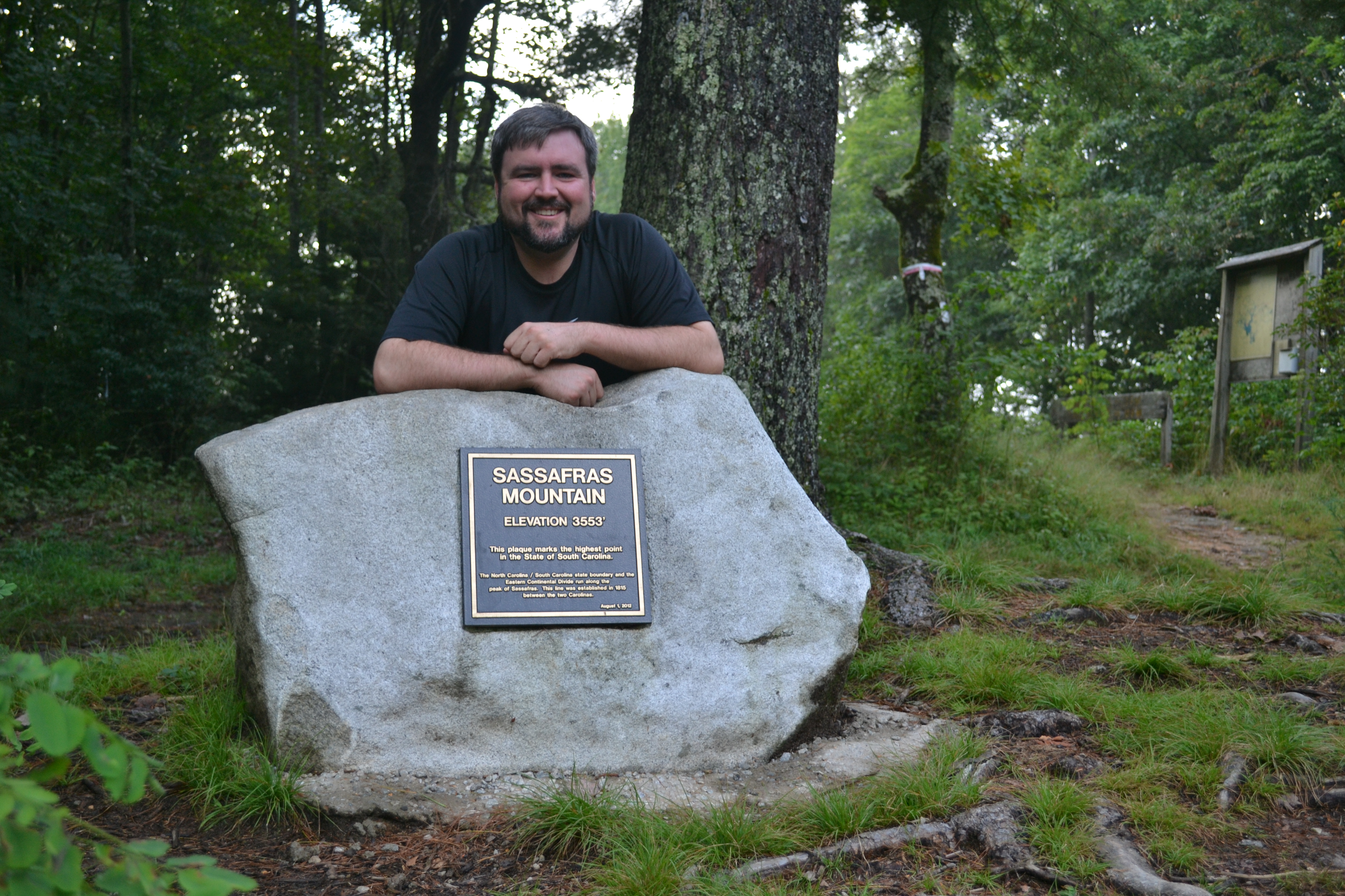
Taking a quick picture behind the monument on top of Sassafras Mountain
(Sassafras Mountain Photo Gallery)
I had been planning on making a trip to bag another highpoint over Labor Day, and I had pretty much set myself on going to Mount Magazine in Arkansas. A buddy of mine, who was going to go but had to back out, suggested heading over to the Carolinas, Georgia and Tennessee, part of the Southern Six-Pack. It made sense because it was the same distance to Brasstown Bald in Georgia as it was to Mount Magazine.
After finally making up my mind to travel solo late Friday night, I hopped up Saturday morning and started the trek to South Carolina. My original plan was to do the whole six-pack in one weekend, but once I realized I would not be able to do that in the amount of time I had, I settled on bagging the Carolinas, Georgia and Tennessee.
After packing for the trip, I set my GPS to find Rocky Bottom, South Carolina, and I took off for Sassafras Mountain. There are two important notes you should take away from this about South Carolina: the gas is much cheaper than elsewhere and GPS is a fickle mistress when closing in on Sassafras Mountain.
The spotty GPS and a detour made me wonder about making it, but I finally did. Once I had the way figured out, a thunderstorm rolled into the area, killing my idea to hike to the top. Instead, I kept following a winding road (that I am not sure has a name) and found a parking lot. The storm was starting to subside, so I thought I would be able to catch a trail from the parking lot and make my way up to the high point. Only I could not find a trail that gained elevation.
Figuring that the highpoint was near, I started looking around for some sort of sign, but I could not find anything. There was a nice observation deck that allowed for good pictures of the area, but I wanted something to prove that I had made it to the top. I finally broke down and asked a group where the summit was located, and they said the parking lot was it.
However, there was a hill behind us, so I had doubts as to that being the highest point. I walked up the paved road, and it led to the top of Sassafras Mountain. There is a geological marker from South Carolina and a marker placed in another location. I am not sure which is the true highpoint.
There is also a cell phone tower that my ATT phone apparently cannot hit.
Sassafras Mountain is pretty busy. The Eastern Continental Divide runs along it as does the border of North Carolina and South Carolina.
There are several hiking trails leading to the top, and it also connects to several long trails. I took a trip down the Chimney Gap Trail to try to find a non-cloudy look out spot. I didn’t have much luck, but it was a pretty nice trip to make.
