Category Archives: Uncategorized

No Wizardry, Just a Great View: Mt. Greylock, Massachusetts (21/50)

Ben at the summit of Mt. Greylock

Ben just grabbed a seat after walking across the summit of Mt. Greylock. It’s hard to blame him. Mt. Greylock Photo Album

After our adventures in Rhode Island, the time came to make the about two hour trip back to Massachusetts and pick up the highpoint of the Bay State.

All of the time I had ever spent in Massachusetts had been in Boston and along the cape, so I didn’t know what to expect from the mountainous area of the commonwealth.  I quickly learned that it was much better than I had expected.

Mt. Greylock has been featured in literature, and it has inspired writers in the past.  J. K. Rowling placed a school of wizardry on the mountain in 2016 (spoiler alert….we didn’t find it), and Nathaniel Hawthorne and Herman Melville both found it as muse of sorts in their writing.  After hiking the mountain and sitting at its summit, it is easy to see why.

Continue reading

On the Road to Rhode Island: Jerimoth Hill, RI (20/50)

jerimoth hill start

After nearly missing the start of the trail a few times, we were finally headed to the highpoint of Rhode Island. (Jerimoth Hill, RI Photos)

First off…isn’t it crazy how life gets busy and next thing you know, you are a year behind on your blog posts?!?

Ever have one of those days where you want to accomplish something, but don’t really know how much you will take down?  That was our day of highpointing Rhode Island and Massachusetts.  At one point, I had the grand plan of adding Connecticut to that list, but thanks to sleeping in, not so good recognition skills, and spotty C-Spire service, stop No. 3 had to be skipped.  Oh well, the other two stops were still pretty good.

When you think of Jerimoth Hill, you don’t think of danger.  Nope, you save that for places like Denali or Mt. Rainier.  I mean, what could be dangerous about Jerimoth Hill?  Getting hit by a car while crossing the street?  Well, back in the day, getting shot was up on the list.  You see, Jerimoth Hill was on privately owned land, which has since been transferred, but before that transfer, folks had been threatened with being shot for attempting to reach the highest point of the Ocean State.

Continue reading

Snagging the Rockpile: Mt. Washington, New Hampshire (19/50)

mt washington summit

At the summit of Mt. Washington, the highest point in New England. (Mt. Washington photos)

The Mississippi Gulf Coast has had one wet and rainy summer, so it should be little surprise that a storm messed with our plans to drive up the Mt. Washington Auto Road to grab the highest point in New England.  However, after a great trip to Portsmouth, we set out the next day to snag the highpoint of New Hampshire.

The Mt. Washington Auto Road is a private road that many call one of the scariest roads in the United States.  Narrow, with many tight turns, one has to be fairly self-assured to drive a car up the road. While I was ready for such a challenge, Mother Nature (some may say Divine Intervention) did not all me to partake as weather forecasts called for severe storms in New Hampshire’s mountains.  An outdoor adventure race up the auto road cancelled any driving plans for the following day as well, leaving us only the option of taking the cog railway up to the top of the mountain as hiking this one with Ben at this time seemed sort of unlikely.

Continue reading

The Highpoint by a Sidewalk: Ebright Azimuth, Delaware (18/50)

Ebright Azimuth Sign

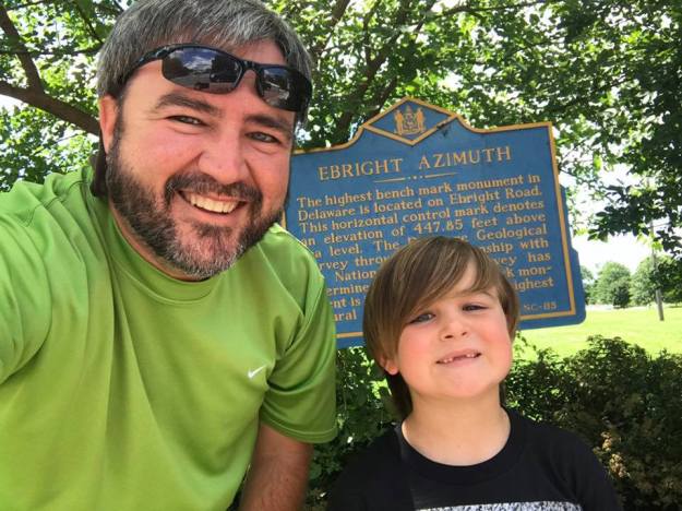
Ben and I in front of the sign explaining Ebright Azimuth. The actual geodetic marker is about 20 feet away.  (Ebright Azimuth photos)

Tom Petty once said that good love is hard to find.  Apparently, one of the easiest highpoints to snag in all of the United States might be too, at least for me, as I drove past the Delaware highpoint four times.

Located just inside Delaware’s border with Pennsylvania, Ebright Azimuth does not do much in the way of standing out.  In fact, my son still asks if Delaware’s highpoint is also its second lowest point. The confusion is understandable as this spot checks in at a less than whopping 447.85 feet.

However, as with some other highpoints, there are some quirky characteristics to Ebright Azimuth.  For starters, the geodetic marker is found in a cut out area of a sidewalk.  That’s right.  At one point, this marker was going to be paved over for a sidewalk. Those plans were changed, and instead, the marker was bypassed when the sidewalk was built.

This sidewalk is located in a neighborhood, so one has to wonder if some local jogger has the record for most trips to the highest point in Delaware.  It seems likely to assume there may well be someone who has ascended Ebright Azimuth hundreds or maybe more than a thousand times.

While the elevation of the highpoint may not pack much sizzle, the folks maintaining the highpoint have done a pretty nice job making it a bit more special.  There are signs explaining the highpoint and a bench for sitting if needed.

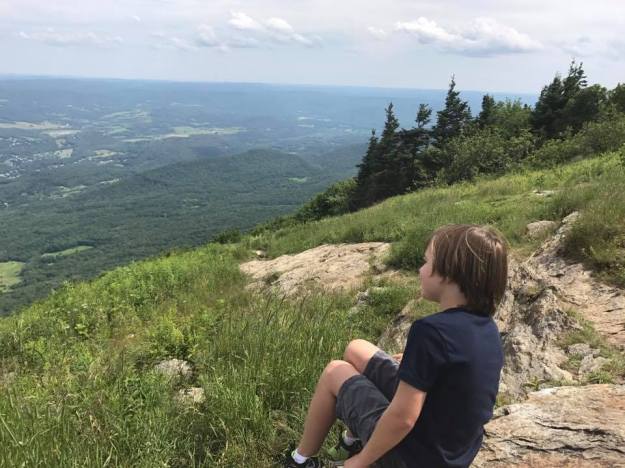
Ben and I snagged this highpoint as part of a trip up to New England to see how many highpoints we could get.  After hanging around this highpoint for just a bit, we hit up Dunkin Donuts and started a push toward New Hampshire.

The parking for this highpoint can be a bit tricky.  There are traffic control measures in place that making parking on the side of the road next to the highpoint very difficult.  Additionally, there are two private roads in the area to complicate things more.  However, there is what looks to be an abandoned road between the highpoint and the state line.  That looks like your best bet for parking and snagging this highpoint.

Panorama Point Temporarily Closed

Due to road conditions, Panorama Point, the highest point in Nebraska has been temporarily closed.

Please do not try to walk the road as bison roam inside the gates.

The Top of the Allegheny Mountains: Spruce Knob, WV (17/50)

There are few states that can match West Virginia in terms of beauty.  Going back to childhood visits with my grandparents in Lower Burrell, Pennsylvania, I have made many trips to and through West Virginia, and every time, I leave thinking that it is a special place.

That same feeling remained after making a visit to Spruce Knob, the first highpoint of 2016 for Ben and me.

(Spruce Knob Photo Album)

The trip to Spruce Knob took a while to develop this summer.  A week before heading that direction, we were riding around Key West on a moped going to see the southern most publicly accessible point (or so they say) on the mainland of the United States.  After a quick trip back home, a few days in Atlanta, and a visit with family in Charlotte, we began the trip to West Virginia.

Let me warn anyone who suffers from motion sickness.  You will either need to take medicine, sleep, or drive when going through the mountain roads to this highpoint.

Continue reading

Picking up the Keystone State: Mt. Davis, Pennsylvania (16/50)

After picking up our coldest highpoint in MarylandTaum Sauk Mountain is a close second as it was only one degree warmer), we headed north to Pennsylvania to pick up Mt. Davis for our second highpoint of the day.

                               (Photos from Mount Davis)

One of the things that I will always remember about the drive was passing a city called Friendsville.  You see, I am a huge fan of The Walking Dead, and if there was ever a town with a name that should be on that show, Friendsville is it.  Couldn’t you just see getting there and everyone acting nice only to find out that they stole and killed from people looking for refuge?  Maybe they even have a zoo of walkers?  I digress.

Another thing to remember were the amount of wind turbines on the mountains as we headed to Mt. Davis.  I remember thinking that it was great to see people taking advantage of a renewable energy source, but even then, it was impossible not to note how much they had changed the landscape.

Continue reading

Bagging Backbone Mountain: Maryland (15/50)

MD Highpoint sign

Getting ready to head to the highpoint of Maryland 

Backbone Mountain (3360 feet) Photo Album

First things first…I’ve got to get more timely in writing these posts….

Thanksgiving week always makes for an interesting time in my household.  It marks the end of college football season and rivalry games, especially the Battle for the Golden Egg, celebration with family, and working out time for my son to spend time with me, my family and his mom and her family.  One week does not always seem like enough.

Thankfully, I have an awesome family who knows that those of us in the education business are limited with our time off and when it occurs, and his mom is pretty flexible when I want to take him on a trip, so we decided to forego football (good thing because Mississippi State got popped hard), have an early Thanksgiving dinner, and then take off on a fast five-day trip to Backbone Mountain, Mount Davis, Gettysburg and Washington D.C.

Continue reading

Snagging Virginia to Finish the Southern Six Pack: Mt. Rogers (14/50)

Benjamin and I standing next to the sign pointing out the final route to the Mt. Rogers Summit.  (Mt. Rogers Photo Album)

Benjamin and I standing next to the sign pointing out the final route to the Mt. Rogers Summit. (Mt. Rogers Photo Album)

A couple of years ago, I had an idea to use Labor Day weekend to knock out the Southern Sixpack.  Thanks to some really bad planning and some ugly weather, the goal did not happen, and instead, it became something I would accomplish in steps.  Looking back, I am glad it happened that way because it turned out that hiking to the top of Mt. Rogers became an awesome father-son trip instead.

Unlike most of the highpoints east of the Mississippi River, the summit of Mt. Rogers can only be reached by hiking.  There are no roads to get you close for a quick jaunt to the top.  While my son and I have hiked various lengths to our highpoints—except Flordia, Ohio, and Indiana because really, why?—none of them had shaped up to be as long as Mt. Rogers.  A year ago, I decided to cut it out of a trip we were making because I did not know if his four-year old self could handle it. A year later, I had some doubts about his five-year old self, but after asking around, I decided we would give the eight-plus mile roundtrip trek a go.  If we made it all the way to the top, it would be great. If we had to turn around, we would.  I should have known we would not have to turnaround after seeing his reaction to finding out I had some doubts if we would make it to the top while we were staying in Blowing Rock after a visit to Grandfather Mountain—two places I recommend.

Knowing that it would be an all day affair, we camped the night before at Grayson Highlands State Park. While it is touch more expensive than some other campgrounds, the facilities are top-notch, and being within five minutes of the Massie Gap trail heads makes for an added bonus.  They have attendants who come by the sites selling ice and firewood, and many forgotten items can be snagged in the camp store.  The view of the sky from the open areas are great as well, an added bonus for those who like stars.  After calling it a night, a storm rolled through, making sleeping even easier, and the next morning, it was time for quick showers, packing up, breakfast and hitting the trail.

My son, Ben, at the start of the Rhododendron Trail.

My son, Ben, at the start of the Rhododendron Trail.

Continue reading

Bouncing to the Top of the Buckeye State: Campbell Hill (13/50)

We made it to the top of Ohio.

We made it to the top of Ohio. (Campbell Hill Photos)

A weekend road trip to a football game in Lexington, Kentucky, turned into a two highpoints in a day trip as well.  After fighting all of the bugs to get to the top of Indiana, Benjamin and I hopped in the car and headed east to Bellefontaine, Ohio, to find Campbell Hill and the top of the Buckeye State at 1549 feet.

While the highpoint itself is a bit on the disappointing side, the city had a few interesting quirks to it. For starters, McKinnley Street claims to be the World’s Shortest Street.  While there is contention to that claim, namely the Guinness Book of World Records gives that claim to Ebenezer Place in Wick, Scotland, McKinnely Street could be called the shortest street in the United States.

https://vine.co/v/OhwhaapubiI/embed/simple

Continue reading