Tag Archives: highpoints

On the Road to Rhode Island: Jerimoth Hill, RI (20/50)

jerimoth hill start

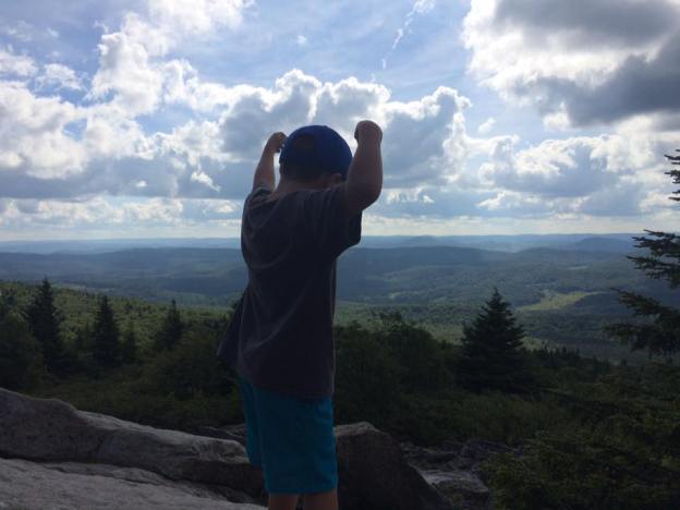
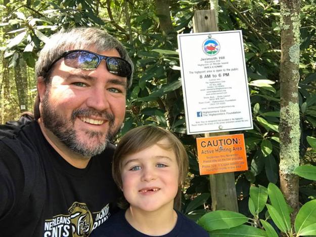
After nearly missing the start of the trail a few times, we were finally headed to the highpoint of Rhode Island. (Jerimoth Hill, RI Photos)

First off…isn’t it crazy how life gets busy and next thing you know, you are a year behind on your blog posts?!?

Ever have one of those days where you want to accomplish something, but don’t really know how much you will take down?  That was our day of highpointing Rhode Island and Massachusetts.  At one point, I had the grand plan of adding Connecticut to that list, but thanks to sleeping in, not so good recognition skills, and spotty C-Spire service, stop No. 3 had to be skipped.  Oh well, the other two stops were still pretty good.

When you think of Jerimoth Hill, you don’t think of danger.  Nope, you save that for places like Denali or Mt. Rainier.  I mean, what could be dangerous about Jerimoth Hill?  Getting hit by a car while crossing the street?  Well, back in the day, getting shot was up on the list.  You see, Jerimoth Hill was on privately owned land, which has since been transferred, but before that transfer, folks had been threatened with being shot for attempting to reach the highest point of the Ocean State.

Continue reading

The Top of the Allegheny Mountains: Spruce Knob, WV (17/50)

There are few states that can match West Virginia in terms of beauty.  Going back to childhood visits with my grandparents in Lower Burrell, Pennsylvania, I have made many trips to and through West Virginia, and every time, I leave thinking that it is a special place.

That same feeling remained after making a visit to Spruce Knob, the first highpoint of 2016 for Ben and me.

(Spruce Knob Photo Album)

The trip to Spruce Knob took a while to develop this summer.  A week before heading that direction, we were riding around Key West on a moped going to see the southern most publicly accessible point (or so they say) on the mainland of the United States.  After a quick trip back home, a few days in Atlanta, and a visit with family in Charlotte, we began the trip to West Virginia.

Let me warn anyone who suffers from motion sickness.  You will either need to take medicine, sleep, or drive when going through the mountain roads to this highpoint.

Continue reading

Picking up the Keystone State: Mt. Davis, Pennsylvania (16/50)

After picking up our coldest highpoint in MarylandTaum Sauk Mountain is a close second as it was only one degree warmer), we headed north to Pennsylvania to pick up Mt. Davis for our second highpoint of the day.

                               (Photos from Mount Davis)

One of the things that I will always remember about the drive was passing a city called Friendsville.  You see, I am a huge fan of The Walking Dead, and if there was ever a town with a name that should be on that show, Friendsville is it.  Couldn’t you just see getting there and everyone acting nice only to find out that they stole and killed from people looking for refuge?  Maybe they even have a zoo of walkers?  I digress.

Another thing to remember were the amount of wind turbines on the mountains as we headed to Mt. Davis.  I remember thinking that it was great to see people taking advantage of a renewable energy source, but even then, it was impossible not to note how much they had changed the landscape.

Continue reading

Snagging Virginia to Finish the Southern Six Pack: Mt. Rogers (14/50)

Benjamin and I standing next to the sign pointing out the final route to the Mt. Rogers Summit.  (Mt. Rogers Photo Album)

Benjamin and I standing next to the sign pointing out the final route to the Mt. Rogers Summit. (Mt. Rogers Photo Album)

A couple of years ago, I had an idea to use Labor Day weekend to knock out the Southern Sixpack.  Thanks to some really bad planning and some ugly weather, the goal did not happen, and instead, it became something I would accomplish in steps.  Looking back, I am glad it happened that way because it turned out that hiking to the top of Mt. Rogers became an awesome father-son trip instead.

Unlike most of the highpoints east of the Mississippi River, the summit of Mt. Rogers can only be reached by hiking.  There are no roads to get you close for a quick jaunt to the top.  While my son and I have hiked various lengths to our highpoints—except Flordia, Ohio, and Indiana because really, why?—none of them had shaped up to be as long as Mt. Rogers.  A year ago, I decided to cut it out of a trip we were making because I did not know if his four-year old self could handle it. A year later, I had some doubts about his five-year old self, but after asking around, I decided we would give the eight-plus mile roundtrip trek a go.  If we made it all the way to the top, it would be great. If we had to turn around, we would.  I should have known we would not have to turnaround after seeing his reaction to finding out I had some doubts if we would make it to the top while we were staying in Blowing Rock after a visit to Grandfather Mountain—two places I recommend.

Knowing that it would be an all day affair, we camped the night before at Grayson Highlands State Park. While it is touch more expensive than some other campgrounds, the facilities are top-notch, and being within five minutes of the Massie Gap trail heads makes for an added bonus.  They have attendants who come by the sites selling ice and firewood, and many forgotten items can be snagged in the camp store.  The view of the sky from the open areas are great as well, an added bonus for those who like stars.  After calling it a night, a storm rolled through, making sleeping even easier, and the next morning, it was time for quick showers, packing up, breakfast and hitting the trail.

My son, Ben, at the start of the Rhododendron Trail.

My son, Ben, at the start of the Rhododendron Trail.

Continue reading

Bouncing to the Top of the Buckeye State: Campbell Hill (13/50)

We made it to the top of Ohio.

We made it to the top of Ohio. (Campbell Hill Photos)

A weekend road trip to a football game in Lexington, Kentucky, turned into a two highpoints in a day trip as well.  After fighting all of the bugs to get to the top of Indiana, Benjamin and I hopped in the car and headed east to Bellefontaine, Ohio, to find Campbell Hill and the top of the Buckeye State at 1549 feet.

While the highpoint itself is a bit on the disappointing side, the city had a few interesting quirks to it. For starters, McKinnley Street claims to be the World’s Shortest Street.  While there is contention to that claim, namely the Guinness Book of World Records gives that claim to Ebenezer Place in Wick, Scotland, McKinnely Street could be called the shortest street in the United States.

https://vine.co/v/OhwhaapubiI/embed/simple

Continue reading

Hitting the Top of the Hoosier State: Hoosier Hill (12/50)

Here we are at the top of Hoosier Hill.  Ben has his morpher, you know, just in case we need to become Power Rangers.

Here we are at the top of Hoosier Hill. Ben has his morpher, you know, just in case we need to become Power Rangers. (Hoosier Hill Photos)

When thinking about high points, one would not consider making a trip to Indiana.  After all, Indiana conjures up images of basketball and farmland, not high elevation, but every state has one and at 1257 feet, Hoosier Hill stands taller than a handful of other highpoints in the United States.

A few things made this trek one that will always lodge a special place in my memory.  For starters, I made sure to hit this highpoint on my way to the Mississippi State-Kentucky football game that weekend.  If you are wondering why this game will always stand out, that game marked the first time the Bulldogs had played a game as the No. 1 team in the nation. As a Mississippi State graduate and fan of the team, I just had to be at that game.

Continue reading

The Busiest Highpoint: Clingmans Dome, Tennessee (11/50)

For some reason, they moved the highpoint marker from the top down to the start of the summi trail at Clingmans Dome

For some reason, they moved the highpoint marker from the top down to the start of the summi trail at Clingmans Dome

Photos from Clingmans Dome

When it comes to highpoints, none receive more visitors than Clingmans Dome, the highpoint of Tennessee.  Standing at 6644 feet, the mountain, which sits on the Tennessee and North Carolina border, is the third highest point east of the Mississippi River behind only Mt. Mitchell and Mt. Craig in North Carolina.

Clingmans Dome sits in the Great Smoky Mountains National Park, and it is just one of many places worthy of a visit while spending time in the park. For those looking to avoid a long hike, a trip during the warmer months of the year (April-December) allows one to have the opportunity to drive near the top of the mountain and take the half-mile trail to the summit.  If you go during the winter months, the Clingmans Dome road is closed, making the journey a bit longer.

Continue reading