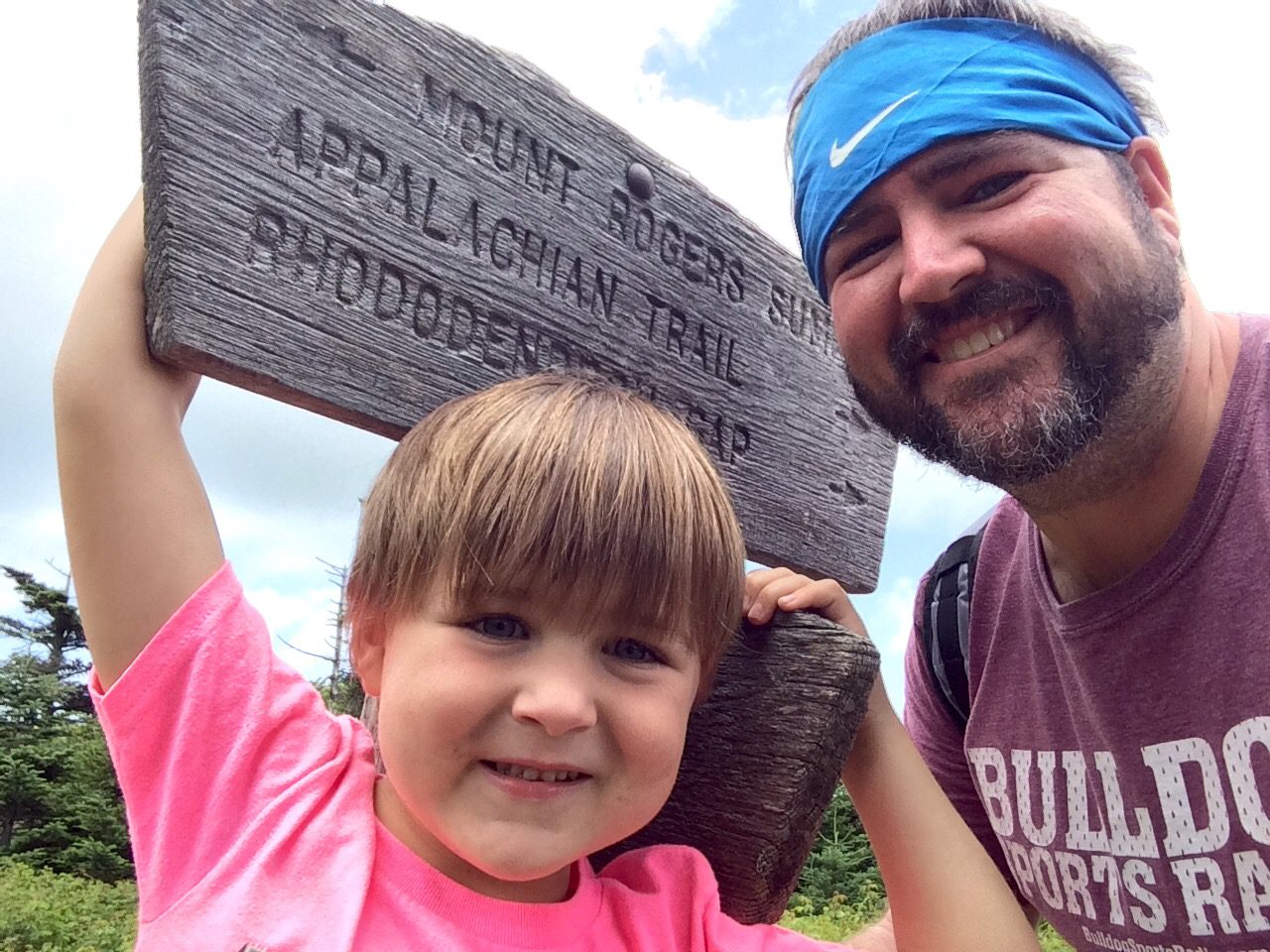

Benjamin and I sitting next to the cairn that marks the summit of Driskill Mountain
(Going to Driskill Mountain Photo Album)
The first stop of what will hopefully be my journey of fifty stops turned out to be Driskill Mountain, which is located just outside of Arcadia, Louisiana, about 60 miles to the east of Texas.
Along with me on the trip was my three-year old son, Benjamin, who found the idea of climbing “highest mountain” (thanks Dora) to be beyond exciting.
I had some worries early when I woke up in Brandon, Mississippi, to the sound of rain, but we decided to head on over to Driskill Mountain and hope for the best. When we crossed the Mississippi River into Louisiana, it looked like it might not work out too well for us.
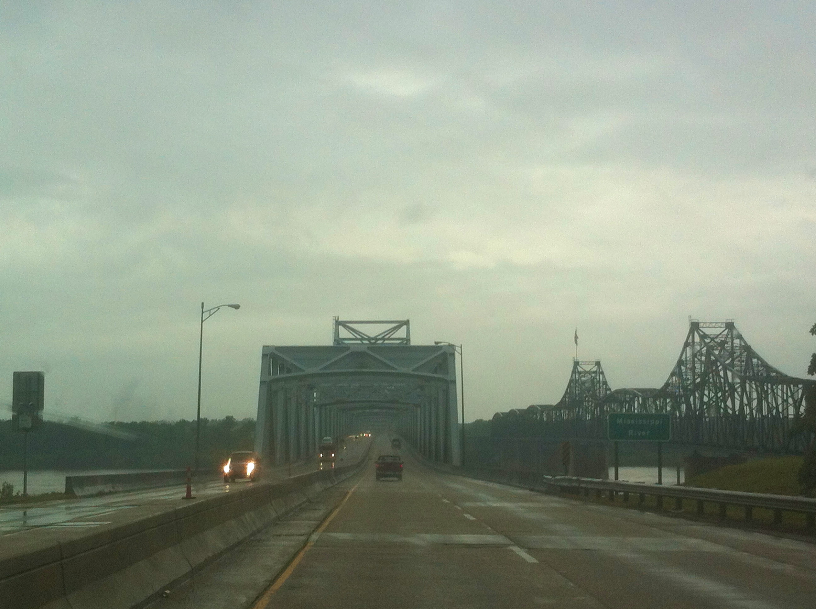
The skies did not look promising as we crossed the Mississippi River in Vicksburg.
However, we found the skies clearing as we came closer to our destination, and we had an enjoyable trip to the top.
I had never stood on a highpoint of any state until reaching the top of Driskill Mountain. While it is hardly a mountain, there is something really cool about being at the highest point in a state. It is one of those things that many people will never do in any state, so I am glad to have done it once (and of course, hopefully many more times).
Being able to bring my son along made it even more fun. Since he is only three, there will be many climbs that he will not be able to make with me, so I want to bring him along on all of the ones that I know he can walk (or that I can carry him on my shoulders). I have no idea how much of the trip he will remember, but I know that I will not forget our conversations, his questions, and his happiness and amazement when I told him we were on the top of Driskill Mountain.
The Way There and the Path To the Top
We decided to head up to the top of Driskill Mountain from the trailhead found at Mt. Zion Presbyterian Church just off of Louisiana State Highway 507. There is plenty of parking, and a sign for the start of the trail is situated next to the cemetery.
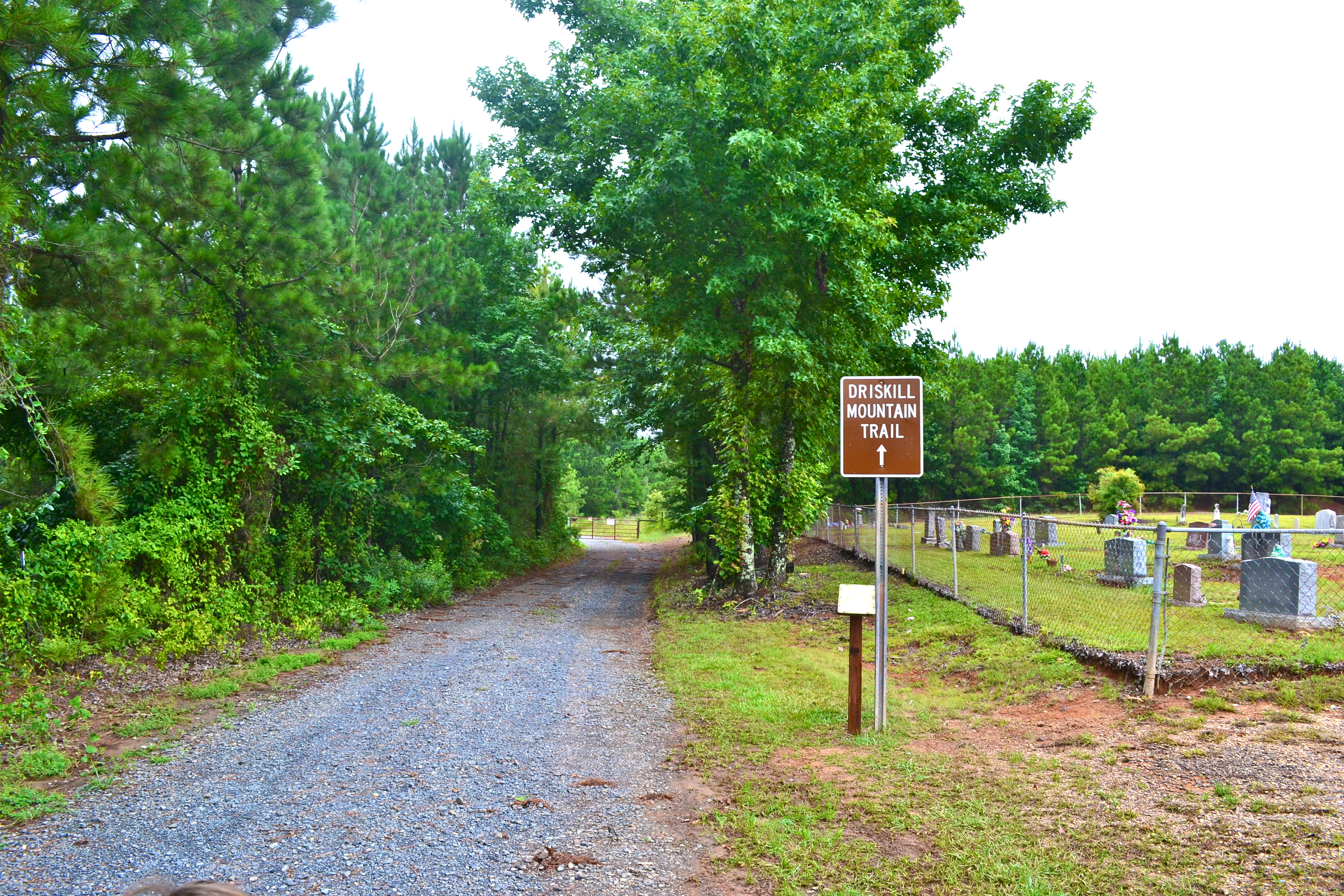
Located next to the cemetery at Mt. Zion Presbyterian Church, the path to the top of Driskill Mountain is well defined.
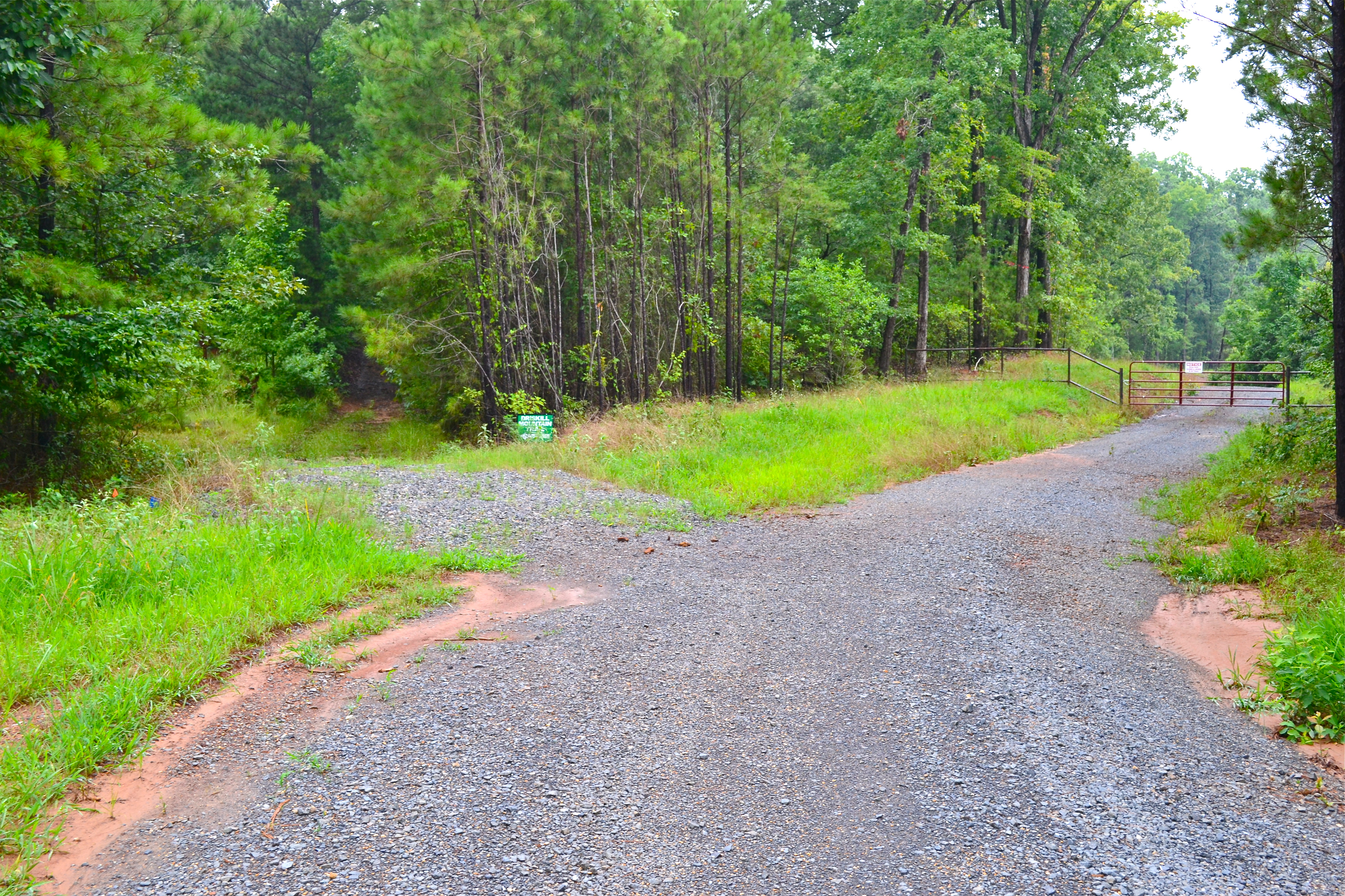
The path starts off with a gravel trail that soon gives way to a more natural terrain made mostly of red clay. This material, common to those who live in the South, can be quite difficult to get off of shoes, especially when wet, so plan accordingly. After walking for a few minutes, the path forks, and those hoping to reach the summit will take the path to the left.
The path truly begins to the left of this sign. It switches from gravel to natural terrain.
With this path being on private property, I found myself presently surprised by the upkeep the owners of the land had put into keeping the trail useful. The path is well laid out, and it is well marked to help everyone reach their intended destination.
After about ten to fifteen minutes, most people will find themselves at the top of Driskill Mountain.

Be sure to sign the log kept in the army box at the sign.
Once reaching the top, be sure to take the time to take in the Jordan Mountain Overlook. It is a pleasant view, and I hope to be able to go back up and see on a day with less haze.
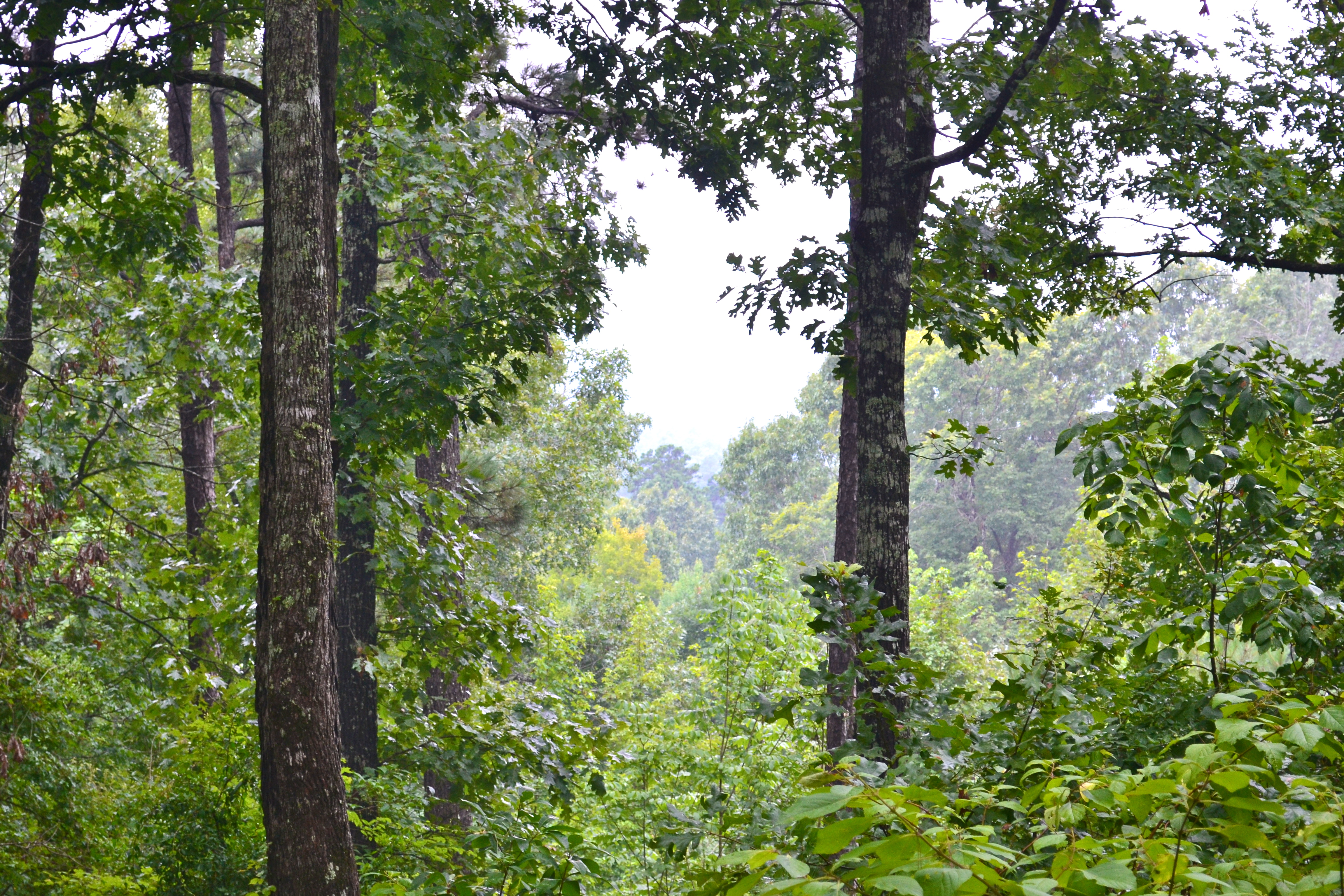
Several other hills can be seen, almost giving a sense of being in a mountain range.
Nearby Points of Interests
I started to look into the area surrounding Driskill Mountain, I learned that the infamous lovebird duo of Bonnie and Clyde met their demise south of a town called Gibsland, Louisiana. The spot of their ambush is about twenty or so minutes away from Mt. Zion Presbyterian Church.
I tried to find the ambush site in Google Maps, but it did not produce a result, so I put together a path that winds to the site, which is located about eight miles or so south of Gibsland on Louisiana State Highway 154.
From the Mount Zion parking lot, head about a quarter of a mile southwest on 507 and take a right onto Jot Em Down Road. Stay on Jot Em Down until it dead-ends with Louisiana Highway 9. Turn left onto Highway 9 and follow it until in joins with Louisiana Highway 517 near Bryceland. Continue straight through this junction as Highway 9 turns off to the left. Next, turn left onto Highway 154 South and follow the road for what will seem like an eternity (it’s really not, there is just little there). Eventually, a sign will appear on the right that says “Historical Marker, 1 Mile.” That sign is fairly accurate, and in about a mile, the monument for the Bonnie and Clyde ambush site will be on the right side of the road.
There is plenty of room off of the road to take pictures or make highly technical and educational vines.
For major enthusiasts of Bonnie and Clyde, there is a museum in Gibsland. It once was the restaurant where the duo ate their final meal. Take Highway 154 north to Gibsland, and it will be on your left. The same route also brings travelers back to Interstate 20.
For those that love old cemeteries, Mt. Lebanon Cemetery, which opened on July 8, 1837, can be found on the same road.

This is such a wonderful idea. I know that you and Benjamin will make many memories during your adventures!